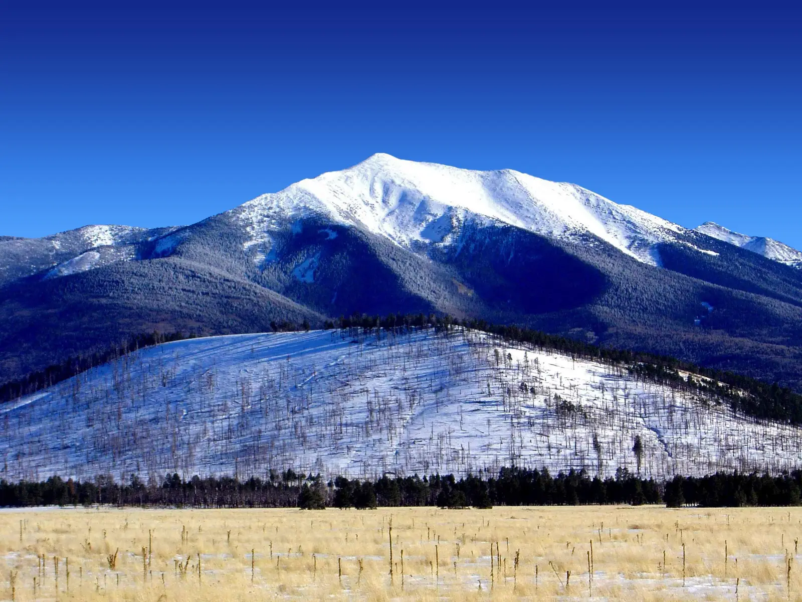
Humphreys Peak is the highest mountain in Arizona and the United States state’s tallest point at 3,850 m. It rises in the Coconino National Forest, north of Flagstaff, and is part of the volcanic San Francisco Peaks. The summit is a popular objective for hikers seeking a long, non-technical climb with big views over the Colorado Plateau.
The mountain is best known for its main trail, which is straightforward to follow but demanding because of the elevation gain and thin air. In clear weather, the summit offers wide panoramas across northern Arizona, with distant views toward Grand Canyon country and surrounding high desert landscapes.
Humphreys Peak is also culturally significant to several Indigenous communities, including the Hopi, Navajo, and Havasupai, who regard the San Francisco Peaks as sacred. Visitors should stay on established routes and respect local guidance, seasonal closures, and weather conditions.
No users yet
No routes yet.
No ascent logs yet. Be the first to log your climb!
The most popular trekking route is the Humphreys Peak Trail, a well-marked out-and-back hike from the Arizona Snowbowl area. It is long, steep in sections, and exposed to wind, but it requires no technical climbing skills. Hikers usually choose it for a direct summit attempt, with alpine meadows, scree, and rocky switchbacks along the way. The route is best for fit hikers who can handle altitude and a full-day effort.
Humphreys Peak is not a classic mountaineering peak, and most ascents follow hiking terrain rather than technical alpine routes. In winter, however, the standard line can become a snow climb requiring traction, an ice axe, and experience with cold-weather navigation. Some climbers combine nearby high points in the San Francisco Peaks for a longer ridge outing, but these are still generally non-technical and depend heavily on snow and weather conditions.
The nearest major city is Flagstaff, about 16 km south of the trailhead area. Most visitors drive north from Flagstaff to the Arizona Snowbowl access road, then continue to the signed trailhead for Humphreys Peak Trail. The approach is short by car but the hike itself is long. In winter, road access may be limited by snow, so checking current conditions before departure is essential.
Guided trips are usually arranged through Arizona Snowbowl, local Flagstaff outfitters, and independent mountain guides offering private day hikes. Prices vary by group size and season, but private guided summit hikes commonly start around USD 200-400 per person, while custom winter or navigation-focused trips can cost more. Because services change often, travelers should confirm current rates, guide credentials, and whether transportation, gear, and permits are included.
The best time to climb Humphreys Peak is usually from late spring through early fall, when the trail is mostly snow-free and temperatures are more stable. July to September can bring afternoon thunderstorms, so early starts are recommended. Autumn often offers cooler hiking weather and clearer views. Winter ascents are possible but much more serious, with snow, ice, strong winds, and rapidly changing conditions that can make the summit unsafe for inexperienced hikers.
For a summer hike, bring sturdy hiking boots, layered clothing, sun protection, at least 2-3 liters of water, snacks, a map or GPS app, and a headlamp if there is any chance of a late finish. Trekking poles help on the descent. In winter or shoulder season, add microspikes or crampons, an ice axe, gloves, a warm hat, and insulated layers. Weather on the mountain can change quickly, even when Flagstaff feels mild.
The slopes of Humphreys Peak support a mix of mountain and forest wildlife. Hikers may see mule deer, elk, squirrels, chipmunks, and many bird species, including raptors and high-elevation songbirds. Black bears are present in the broader region, though encounters are uncommon on the main trail. In summer, insects can be active near wooded sections, and in winter, wildlife is less visible but still present in the surrounding forest.
Start early to avoid afternoon storms, heat, and parking pressure at the trailhead. Acclimatize in Flagstaff if possible, since the summit is nearly 4,000 m and altitude can slow even strong hikers. Carry more water than you think you need, and turn around if lightning, snow, or strong wind develops. Cell coverage can be unreliable on the mountain, so do not depend on internet access for navigation or emergencies.
Humphreys Peak is the highest point in Arizona and the tallest summit in the San Francisco Peaks volcanic range. The mountain is named after Andrew Atkinson Humphreys, a 19th-century U.S. Army officer and surveyor. Its summit area sits above the tree line, giving it a distinctly alpine feel unusual for the southwestern United States. On clear days, the views stretch across a vast high-desert landscape.
How long does it take to climb Humphreys Peak? Most hikers need about 6 to 10 hours round trip, depending on fitness, weather, and trail conditions.
How long does it take to approach Humphreys Peak? The drive from Flagstaff to the trailhead usually takes about 30 to 45 minutes, depending on road and parking conditions.
Is there cell service and internet on the Humphreys Peak? Coverage is inconsistent and often weak or absent on the upper mountain, so internet access should not be expected.
How difficult is it to climb Humphreys Peak? It is a strenuous hike because of the length, elevation gain, and altitude, but it is not technically difficult in summer.
Can beginners hike Humphreys Peak? Yes, fit beginners can attempt it in good weather if they are prepared for a long day, altitude, and changing conditions.
How many people climb Humphreys Peak? It is one of the most popular summit hikes in Arizona, so many hundreds of hikers may visit on busy summer weekends.
No posts yet.